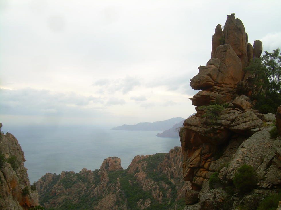
Le Chien (The Dog)
A prominent rock formation that bears a striking resemblance to a dog sitting on the cliffside.
View from the side profile to identify the head and ears.

Navigating the rugged coastline of western Corsica requires understanding the terrain and trailhead locations before setting out. A calanques de piana hike guide ensures you find the right path through the protected rock formations.
Quick answer
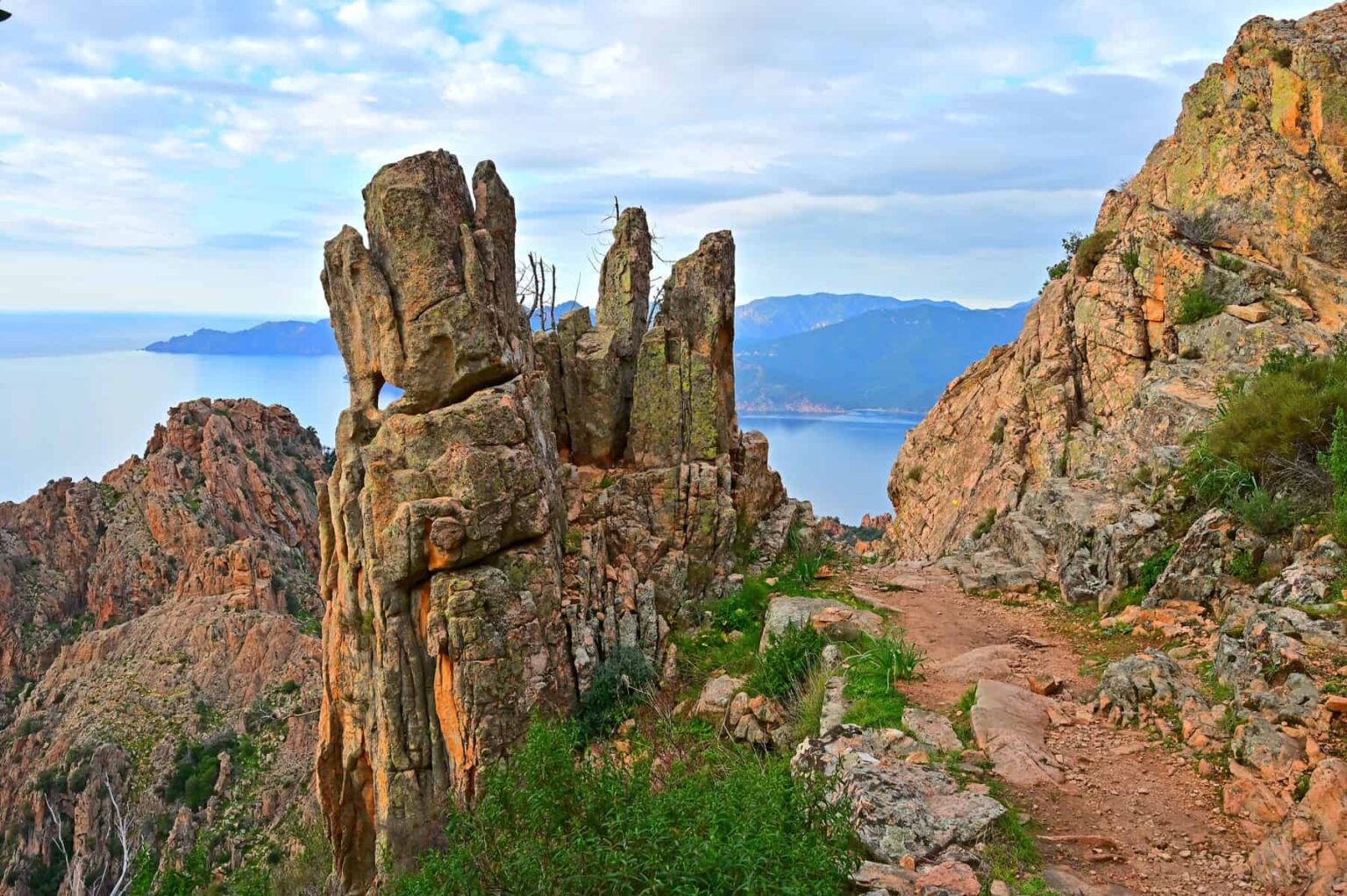
A calanques de piana hike is free to access, with trails remaining open 24 hours a day, Monday through Sunday. The primary trailheads are situated along the D81 road in 20115 Piana, France. Because the routes cross exposed stone with zero shade, arrive between 06:00 and 09:00 to avoid severe heat.
The geological structures towering over the Gulf of Porto began forming millions of years ago, driven by volcanic activity that left behind massive pillars of red porphyry granite. Today, this section of the western Corsica coastline stands as a highly protected natural environment. While many visitors view these jagged cliffs from the water, taking a calanques de piana hike offers an entirely different perspective. Walking through the interior allows you to examine the wind-sculpted tafoni rock formations up close, moving through terrain that marine vessels simply cannot reach. This specific region forms part of a broader UNESCO World Heritage site, which also encompasses the nearby Scandola Nature Reserve and the Gulf of Girolata. Centuries before modern coastal roads existed, local merchants and shepherds navigated these vertical drops using the Ancien Sentier Muletier, or old mule track. Traces of these historic pathways still form the backbone of the region's pedestrian routes. The paths cut through dense Mediterranean maquis scrubland, weaving between towering stone pinnacles that change color from deep ochre to vibrant crimson depending on the angle of the sun. The geography presents severe elevation changes, dropping steeply toward the Mediterranean Sea below. Navigating the area requires careful logistical planning, particularly because the central artery—the winding D81 highway—offers very limited shoulder space for vehicles. Most trailheads originate directly off this narrow road, often forcing walkers to share space with tight traffic before reaching the designated dirt paths. Because the sheer cliff faces provide no natural canopy, pedestrians are exposed to direct sunlight reflecting off the stone. Ground conditions vary from hard-packed dirt to loose, uneven gravel, demanding proper footwear and situational awareness near the unprotected cliff edges. Those utilizing a calanques de piana hike guide will find that the surrounding environment dictates a slow, deliberate pace. Whether traversing the interior forests near Ota or moving toward the prominent Capo Rosso peninsula, the footpaths demand physical preparation. The landscape’s natural constraints mean visitors must carry all necessary provisions, as there are no facilities, water stations, or shelters situated along the ridges themselves. Understanding the raw nature of the rock face and the historical significance of the terrain is essential for a secure excursion into the heart of the Corsican mountains.
“Centuries before modern coastal roads existed, local merchants and shepherds navigated these vertical drops using the old mule tracks.”
The best arrival window is 06:00–09:00 to avoid mid-day crowds and enjoy cooler temperatures for hiking. This early start is essential for navigating the narrow trails comfortably before the peak heat of the day.
Mild, 15°C to 22°C. Ideal for moderate temperatures and blooming flora.
Hot, 25°C to 30°C+. Early morning is necessary to avoid high heat.
Warm, 18°C to 25°C. Stable weather conditions allow for comfortable trail access.
—
Mid-week early starts offer the most quiet environment for hiking.
Verdict: For the best experience, arrive between 06:00–09:00 during the months of May, June, September, or October.
Following the marked hiking routes through the Calanques de Piana takes between one and four hours, depending on the chosen path. This sequence ensures you find the correct trailheads and navigate the cliff terrain safely.
Drive or walk along the D81 road to find the stone markers indicating the trail starts. Visitors often park too far down the winding road and miss the discreet path entrances entirely.
Pick either the shorter Ancien Chemin des Muletiers or a longer coastal hike. Hikers frequently underestimate the steep elevation changes and start the longer routes without proper preparation.
Follow the painted blazes on the red granite rocks to stay on the official paths. People often wander off-trail onto loose scree, which causes dangerous rockfalls and degrades the environment.
Rest at marked clearings like the Chateau Fort plateau to observe the Gulf of Porto. Visitors sometimes stand too close to the unmarked, crumbling cliff edges while trying to take photographs.
Retrace your steps or follow the loop markers back to your original starting point on the D81. Hikers regularly attempt to take shortcuts through the dense maquis brush, leading to dead ends and scratches.
The hiking trails through the Calanques de Piana provide direct access to unique red granite formations sculpted by erosion. These landmarks offer distinct perspectives on the geological composition of the Corsican coastline.
A prominent rock formation that bears a striking resemblance to a dog sitting on the cliffside.
View from the side profile to identify the head and ears.
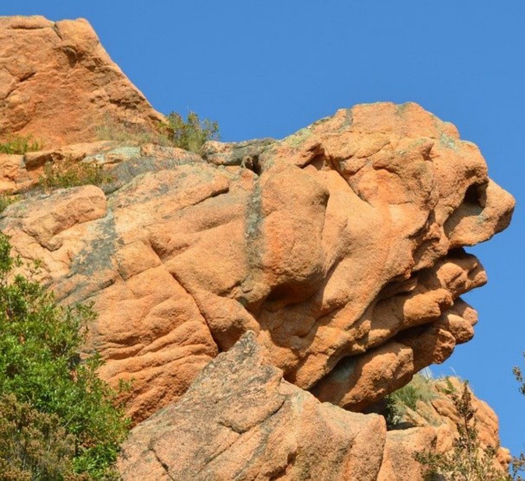
A specific granite protrusion often identified by hikers along the main trail paths.
Use binoculars to observe the fine erosion lines on the rock face.
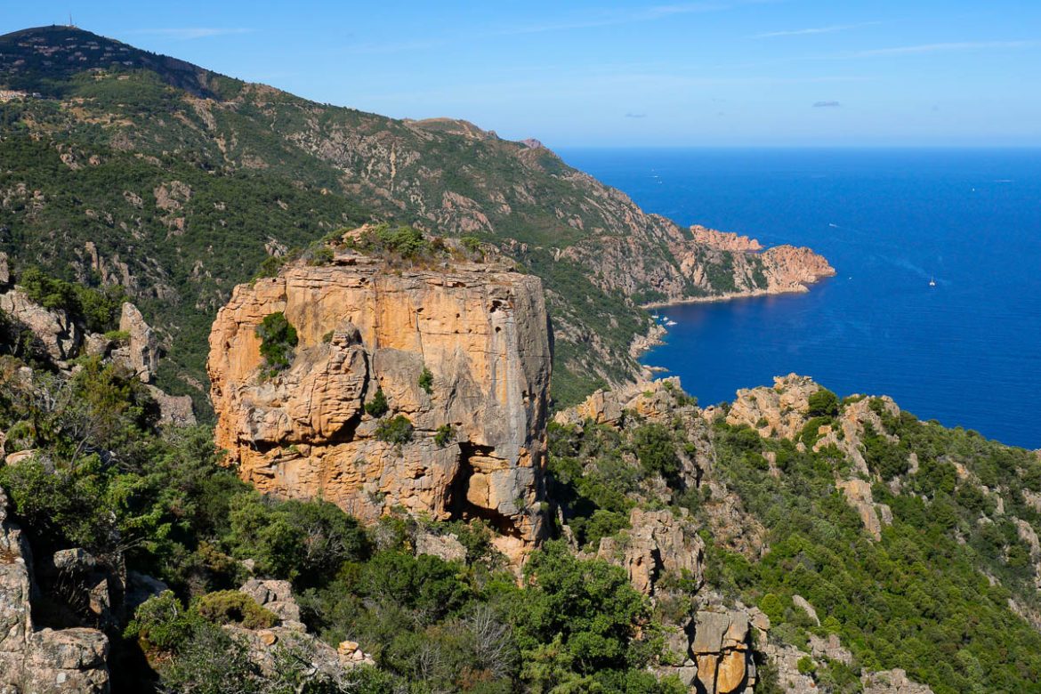
A massive rock cluster resembling a medieval fortress rising above the surrounding vegetation.
Look for this formation when reaching the higher elevation trail segments.
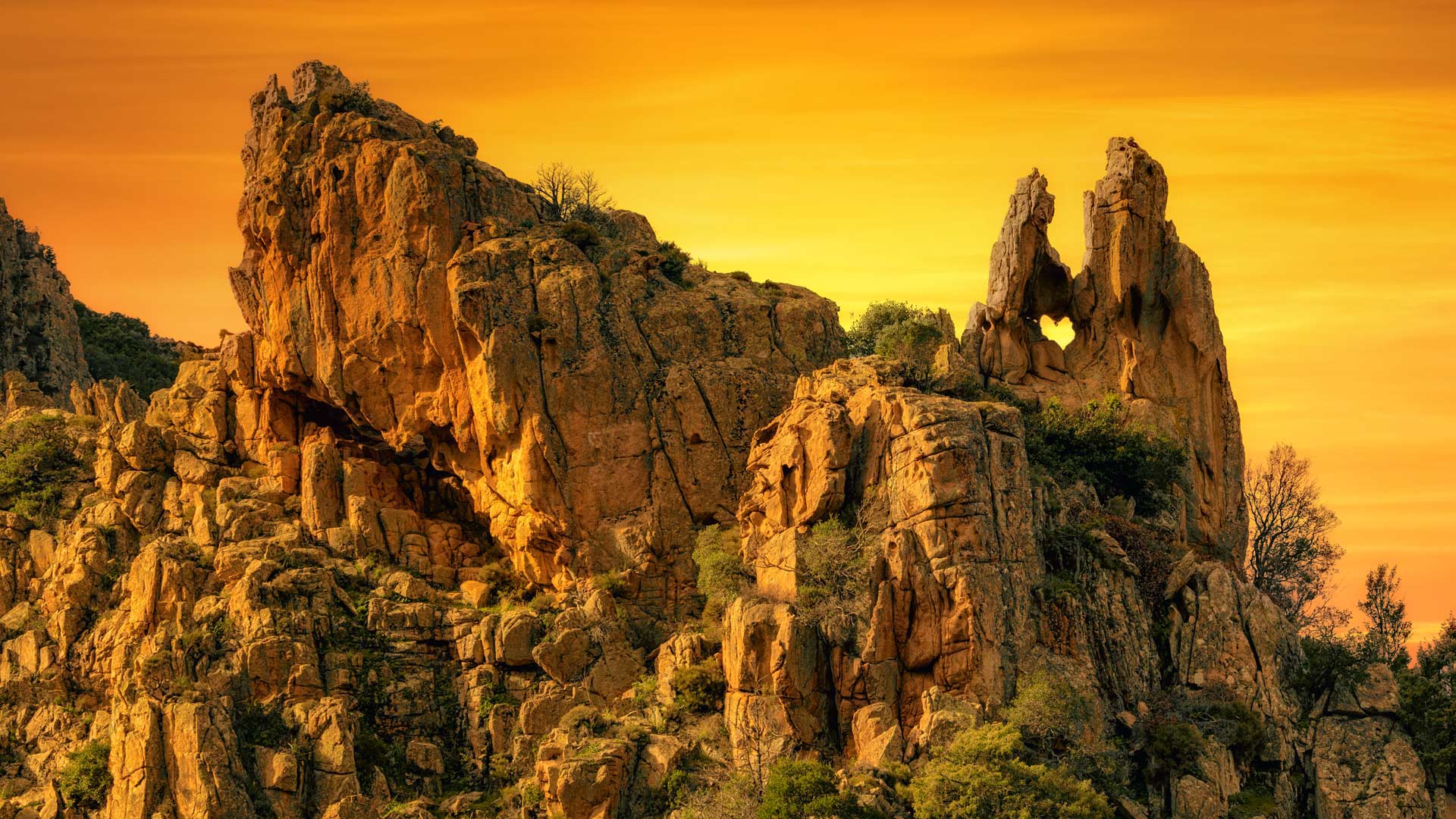
A natural rock cavity in the shape of a heart, located within the granite cliffs.
Position yourself at the marked lookout to frame the heart against the sea.
Preserving the delicate red porphyry rock formations of the Calanques de Piana requires strict adherence to trail guidelines. Proper preparation ensures your safety on steep cliffside paths while minimizing environmental impact.
Organize your gear and hydration strategy before heading out to ensure a safe hike along the cliffs.
The hiking trails within the Calanques de Piana are located in a public natural area and remain accessible to visitors throughout the week.
Everything you need to know about calanques de piana hike
The trails through these red granite rock formations are generally well-marked, but they require sturdy footwear due to the uneven terrain. Navigating the calanques de piana hike requires attention to signage to ensure you remain on the designated path among the jagged porphyry cliffs.
To avoid peak heat and large crowds, the best arrival window is between 06:00 and 09:00. Starting your calanques de piana hike early also provides cooler temperatures, making the rugged ascent along the Mediterranean coastline more manageable.
Access to the trails is free, as there is an entrance fee of 0 EUR. You can enjoy the natural beauty of this UNESCO World Heritage site without needing to purchase a ticket to walk the public paths.
Many sections of the local trail network are suitable for older children, provided they are supervised and capable of walking on rocky surfaces. However, parts of the Piana cliff trail involve steep drops, so caution is advised when hiking with family members.
The area is open every day of the week, allowing you to plan your calanques de piana hike at your convenience. Since the trails are outdoors, ensure you check current weather conditions before setting out to explore the landscape.
While exploring on foot provides an intimate look at the flora and geology, combining your calanques de piana hike with a sea-based excursion offers a different perspective of the coastal formations. After completing your trail walk, viewing these dramatic landmarks from the water is a popular way to appreciate their scale.